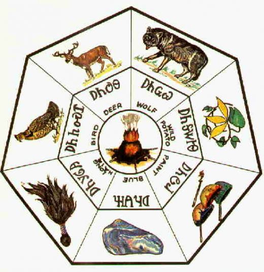
|
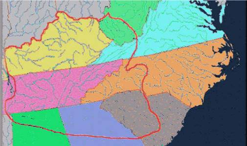
Cherokee Land Cessions (1721-1835)
| At the beginning of the 18th Century,
Cherokee lands extended over a vast area. Major portions of the states
of Virginia, West Virginia, North Carolina, South Carolina, Georgia,
Alabama, Tennessee and Kentucky were part of the Cherokee domain. The map,
shown at the right, depicts the approximate extent of Cherokee land before
the first land cession in 1721.
In all, more than 120,000 square miles of territory were once
contained within the Cherokee Nation. Unfortunately, by 1836, every
single square mile of this Cherokee land had been either voluntarily or
forcibly ceded to the white man!
This loss of territory took place as a result of a series of
22 treaties which occurred during the years 1721 through 1835. The first 6
treaties were with the British Government or one of its colonies. The 7th
treaty, in 1775, was with a private individual, Richard Henderson; it was
considered illegal by the British Crown, by the colonial governors of VA and NC,
and by the successor state governments of VA and NC! The next 3 treaties were
with the state governments of SC, GA, VA and NC. The remaining 12 treaties
were with the United States Government. |
 |
Based on information contained in the book entitled The
Cherokees - A Population History, by Russell Thomas (published 1990), the
following table summarizes these 22 land cessions:
| Date |
Treaty Participant |
Description of Land Ceded |
Square Miles |
| |
|
|
|
| 1721 |
1. Colonial SC |
Tract in SC between Santee, Saluda and Edisto Rivers |
2,623 |
| 24 Nov 1755 |
2. Colonial SC |
Tract in SC between Wateree and Savannah Rivers |
8,635 |
| 14 Oct 1768 |
3. Britain |
Tract in southwestern VA |
850 |
| 18 Oct 1770 |
4. Colonial SC |
Tract in VA, West VA, northeastern TN and eastern KY |
9,200 |
| 1772 |
5. Colonial VA |
Tract in VA, West VA and eastern KY |
10,917 |
| 01 Jun 1773 |
6. Britain |
Tract in GA, north of Broad River |
1,050 |
| 17 Mar 1775 |
7. Richard Henderson |
Tract in KY, VA and TN |
27,050 |
| 20 May 1777 |
8. States of SC and GA |
Tract in northwestern SC |
2,051 |
| 20 Jul 1777 |
9. States of VA and NC |
Tract in western NC and northeastern TN |
6,174 |
| 31 May 1783 |
10. State of GA |
Tract in GA, between Oconee and Tugaloo Rivers |
1,650 |
| 28 Nov 1785 |
11. United States |
Tract in western NC |
6,381 |
| 02 Jul 1791 |
12. United States |
Tract in western NC and eastern TN |
4,157 |
| 02 Oct 1798 |
13. United States |
Tracts in TN and NC |
1,539 |
| 24 Oct 1804 |
14. United States |
Tract in GA known as Walford's Settlement |
135 |
| 25 Oct 1805 |
15. United States |
Tract in KY and TN west of Tennessee River and Cumberland
Mountain |
8,118 |
| 27 Oct 1805 |
16. United States |
Tract in TN of one section at Southeast Point |
1 |
| 07 Jan 1806 |
17. United States |
Tract in TN and AL between Tennessee and Duck Rivers |
6,871 |
| 22 Mar 1816 |
18. United States |
Tract in northwest corner of SC |
148 |
| 14 Sep 1816 |
19. United States |
Tract in AL and MS |
3,433 |
| 08 Jul 1817 |
20. United States |
Tracts in northeastern GA, southwestern TN and northern AL |
1,018 |
| 27 Feb 1819 |
21. United States |
Tracts in northern AL, TN, NC and GA |
5,941 |
| 29 Dec 1835 |
22. United States |
All remaining lands of the Cherokee Nation! |
12,316 |
| |
|
|
|
| |
|
Total Amount of Land Ceded to the White Man (1721-1835) |
120,258 |

|